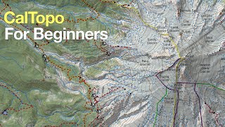
Backcountry Navigation: How to Read a Map, by Backcountry Pilgrim on YouTube. 12 min 31 s.
- Video length
- 12 min 31 s
- Time to do it
- 20 minutes
- Difficulty
- Easy
- Steps
- 9
What you need
Steps
Check the map's title block for the area name, edition date and the agency that made it. Note the date so you know how current the trails and roads are.
Read the scale bar to see how distance on paper compares to real ground. Use it to measure a route with a string or paper edge and convert to miles or kilometres.
Open the legend and learn the symbols for trails, roads, water, buildings and boundaries. Mark any symbol you do not recognise with a pencil.
Find the declination diagram and set your compass to the local magnetic declination. This keeps your compass bearing lined up with the map's north.
Orient the map by turning it until its north lines point to real north, using your compass. Now features on the map line up with what you see around you.
Study the contour lines to read the shape of the land. Lines close together mean steep ground, wide spacing means gentle slopes.
Trace a route and note the high points, valleys and ridges it crosses. Pick a route that matches your fitness and the time you have.
Use the map colors to spot water, vegetation and open ground. Blue is water, green is forest, white or light shades are open terrain.
Fold the map so the section you need is on top and keep it in a zip bag. Check your position against the map at each junction or landmark.
Tips and common mistakes
Carry a paper map even when you use a phone app, since batteries and signal can fail.
Set declination on your compass once and check it again before each trip.
Contour lines that form a V point uphill, which helps you tell valleys from ridges.
Check the map's date, as older maps may miss new trails or closed routes.
Questions
What do contour lines tell me on a topo map?
They show elevation change. Lines packed close together mean a steep climb, while widely spaced lines mean flatter ground.
Why does declination matter when reading a map?
Map north and magnetic north differ by an angle. If you ignore declination, your compass bearing will be off and you can drift off route.
Can I use a map app instead of a paper map?
You can, but apps depend on battery and signal. A paper map keeps working when your phone dies, so carry both.
This guide was drafted from the video's details and general task knowledge. It has not been checked against the full video. Check the video and relevant product instructions before following a procedure. Report a correction.